Summary: Latitude vs. X
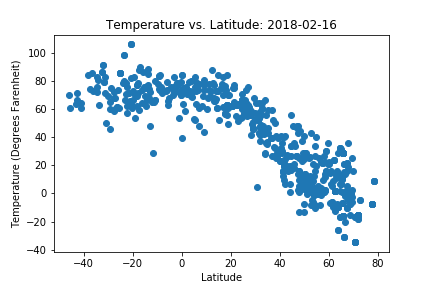
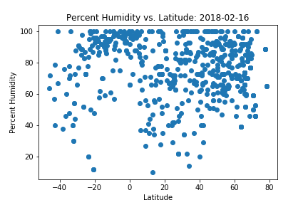
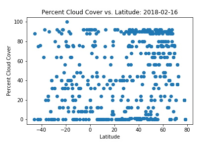
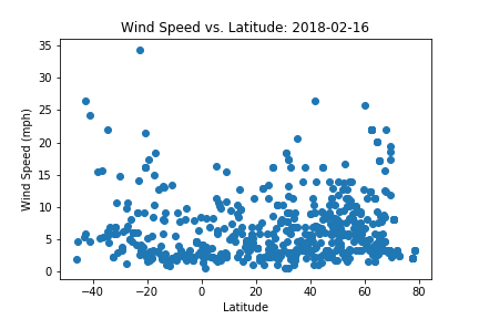
The purpose of this project was to see how weather changes with latitude. First, a large number of random numbers were generated to form coordinate pairs. All coordinates that did fall on land were discarded using google's timezone api. Next the citipy python library was used to find the nearest city to each randomly generated coordinate pair. The open weather map api was then used to find the current temperature, humidity, cloud cover, and wind speed for each city.
Each of these parameters was plotted against the cities latitude to see how temperature varies with distance from the equator. 2500 random coordinate pairs were used to find over 500 cities to perform this analyses. The data and visualizations from this analysis can be found on this site. Click on any of the images on the right to see more analysis.
Visualizations